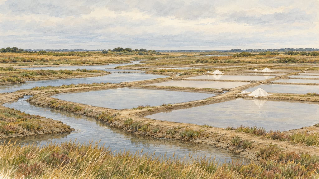
Guérande salt marshes
The Guérande salt marshes are a tidal, sun-worked salina landscape in western France, where brine moves through earthen basins toward small crystallising pans.
 FermenteaWhere food goes to change
Place · salt-evaporation-pans-and-salina
Pomorie salt pans · Pomorie saltworks · Anhialo salt pans
The Pomorie salt pans are a working coastal salina beside Lake Pomorie, where shallow beds use sun and wind to concentrate lake water and yield salt.
Salt has been a major part of Pomorie's working history. The museum's display includes photographs from the beginning of the twentieth century and document copies from the fifteenth through nineteenth centuries concerning salt production and trade. Radio Bulgaria reports that local salt was used to preserve fish and for trade, and dates its history to antiquity. Such statements establish the importance of salt in local memory and reporting, but they do not date the surviving beds.
The exact beginnings and earlier designs need more caution. Some tourism pages say salt pans existed before Pomorie's foundation, around the fifth century BCE. Milcho Skumov's 2019 study abstract warns that historical accounts disagree about the size and structure of the pans, how saltwater moved between basins and how salt was exported; it judges some evidence insufficiently proven. A 2012 Ramsar sheet calls the lake one of the oldest salt-producing areas in the Balkans and Black Sea region but does not give a first year. For that reason, the page describes the living museum installation and its named local tradition without assigning an archaeological date to its present layout.
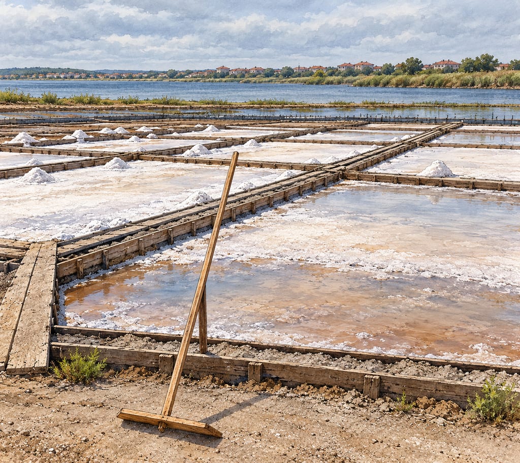
The Pomorie salt pans are part of a coastal salina beside Lake Pomorie, on Bulgaria's Black Sea coast. Their defining feature is not a single pot or pan that a salt maker carries from one place to another. The production surface is a laid-out series of shallow beds separated by low embankments; the beds belong to the site and its water system. The municipal tourism service describes preserved working beds at the Salt Museum as using the old Anhialo technology, with seawater concentrated by the sun.
The museum is an in-situ cultural institution on the Pomorie Saltworks. Its outdoor beds make the landscape itself part of the exhibit, while its building preserves photographs, documents and tools associated with salt production. The National Tourism Portal describes the visitor site as including 20 decares of salt pans. That figure describes the wider outdoor area, not a standard size for each bed.
Salt production begins with water, but the available sources describe the water system at different dates and levels of detail. A 2012 Ramsar information sheet explains that Black Sea saltwater enters the lagoon through tidal movement and infiltration across the sandbar. Water from the open lake moves into cells or pools where its salinity rises; it is then mechanically pumped through a canal to the salt pans. A drainage canal carries water from the salines and freshwater back toward the sea. This account describes the wider wetland system as recorded in 2012, not a complete contemporary hydraulic survey.
A 2024 Radio Bulgaria report describes the museum's operating pans as drawing saltwater directly from Pomorie Lake. It also records a wooden keleve pump, driven by a horse, that can lift water when gravity alone is insufficient. These details show how gravity and animal-powered lifting can be used within the local site; they should not be generalized to every period or every bed. The broader process is consistent across the sources: lake water reaches shallow pans and loses water through sun- and wind-driven evaporation.
The beds are shallow basins separated by wooden and earthen embankments. These dividers keep the working surfaces distinct and organize the water across a larger site. The inspected sources do not provide a standard plan, individual dimensions, depth, wall section or foundation method. A photograph of the present pans shows timber dividers, shallow water, pale salt beds and a long-handled rake, while the museum collection includes wooden salt carts and paddles. The landscape image is therefore useful for identifying the contemporary form, but it cannot supply measurements or a lost builder's sequence.
As water evaporates, dissolved salt is left to be collected by workers. The museum lets visitors observe the operations and speak with salt workers, and a recent report describes collection in hot, dry summer weather. No fixed duration, salinity endpoint or harvest quantity is specified in these sources. This page records the installation and its reported working sequence, not a recipe for building or operating a commercial saltworks.
The salt pans are bordered by Lake Pomorie, a coastal lagoon separated from the Black Sea by a sand strip and connected to it by a canal. Salt-making depends on this relationship between the lake, channels, cells and evaporation beds. The same landscape also supports wildlife: the museum and Ramsar sources identify the lake as a protected area, and the museum account notes the Via Pontica migration route and more than two hundred bird species.
This setting matters when the installation is understood as a build. The pans are not interchangeable with a generic evaporation pond: their name and operation are tied to the Pomorie shore, the local Anhialo tradition, the lake's water and a working museum that preserves the craft. Any reconstruction would require site-specific permission, environmental and structural design, and current water-quality assessment; none of these sources supplies a modern construction plan.
The municipal tourism page describes preserved salt beds using old Anhialo technology, and the museum register dates the in-situ Salt Museum to 2002. Some tourism accounts place salt pans before the town's foundation, while Milcho Skumov's 2019 study abstract says historical descriptions of pan size, structure and water transport differ and that some evidence is insufficiently established. The exact beginning of this build form is therefore not assigned a date here.
This account describes a heritage installation and its reported operation; it is not a civil-engineering design, a food-safety specification or a recommendation to collect salt from a protected wetland.
Reference point from the municipality's embedded location map for the Salt Museum and adjoining salt beds. A complex-level locator, not a surveyed individual evaporation pan.
The Guérande salt marshes are a tidal, sun-worked salina landscape in western France, where brine moves through earthen basins toward small crystallising pans.
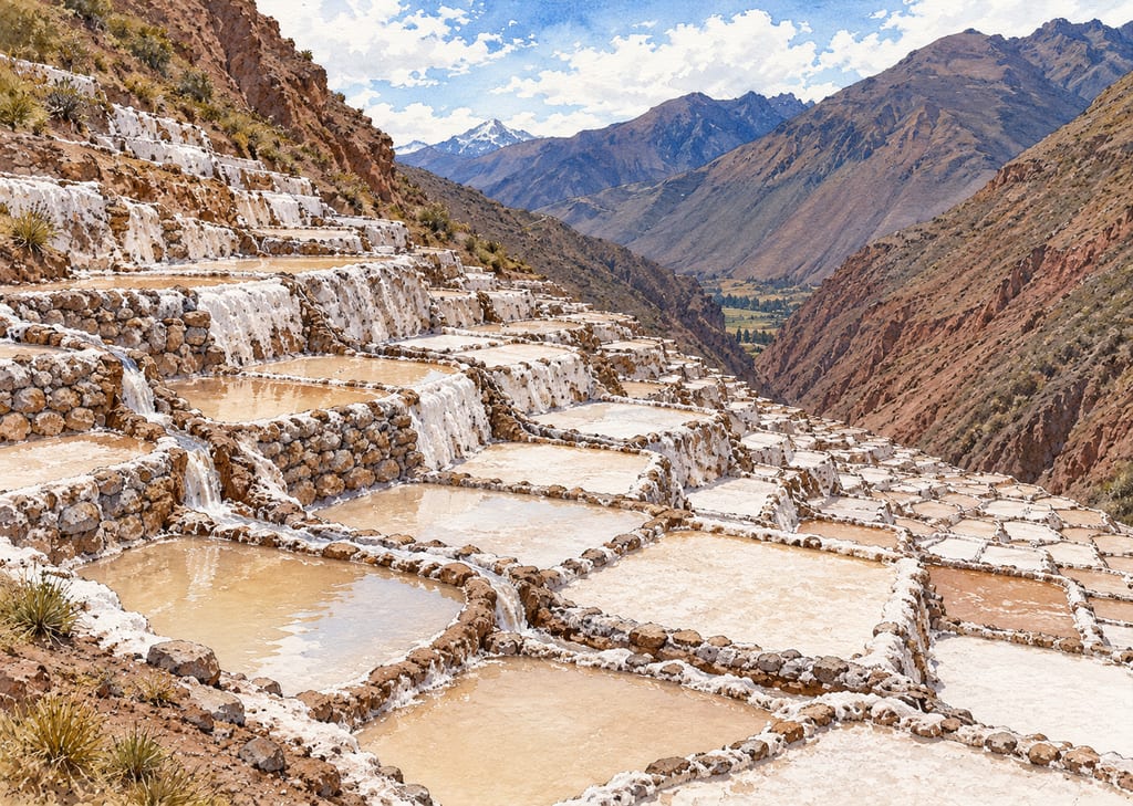
The Salineras de Maras are an Andean spring-fed salina: shallow evaporation wells descend a steep slope, supplied by branching gravity channels from saline water.
No community contributions have been published for this entry yet.
Sign in to contribute. Published comments and photos are free to read.
Municipality of Pomorie Tourist SiteMethod · Geography · Tradition
Salt museum – PomorieThe museum is on the shore of Pomorie Salt Lake.
The municipal page describes preserved salt beds using old Anhialo technology and solar evaporation of seawater.
Cited in: An in-place salt landscape; Water moves through the site; Saltworks and wetland share one place
Bulgarian Museums, site of the Institute for Applied MuseologyHistory · Tools · Geography
Salt Museum - PomorieThe municipal cultural organization was established in 2002 on the territory of the Pomorie Saltworks.
The collection includes early twentieth-century photographs, copies of fifteenth- to nineteenth-century documents, and traditional salt-working tools including wooden carts and paddles.
Visitors can see technological operations; the page describes solar evaporation of seawater.
Cited in: A long history with an uncertain first date; An in-place salt landscape; Beds, embankments and hand tools; Saltworks and wetland share one place
Visit BulgariaStructure · Geography · Method
Salt Museum, PomorieThe outdoor visitor site includes 20 decares of salt pans beside the museum.
The pans are described as basins separated by wood and dirt embankments.
The page describes salt production by solar evaporation and traditional salt-working tools.
Cited in: A long history with an uncertain first date; An in-place salt landscape; Beds, embankments and hand tools
Ramsar Sites Information ServiceHydrology · Geography · Environment
Ramsar Information Sheet: Pomorie Wetland Complex (Site 1229)The 2012 sheet describes a coastal lagoon separated from the sea by a sand strip and connected to it by a canal.
It describes open-lake water moving into cells or pools, increasing in salinity, then being mechanically pumped through a canal to salt pans for solar and wind evaporation; a drainage canal returns water to the sea.
It describes salt production as a historic livelihood and says only a small part of the former salines remained active at the time of the sheet.
Cited in: A long history with an uncertain first date; Water moves through the site; Saltworks and wetland share one place
Radio Bulgaria, Bulgarian National RadioMethod · Tools · Present use · Geography
The hot summer in Pomorie has a taste of saltThe article published on 27 August 2024 reports that the only operating salt pans in Pomorie are part of the Salt Museum and that the brine is drawn directly from Pomorie Lake.
It describes a wooden keleve pump operated with a horse to lift water when gravity alone cannot reach the pans.
The article reports hot, dry summer conditions as favorable for harvesting and notes historic salt use in fish preservation and trade.
Cited in: A long history with an uncertain first date; Water moves through the site; Beds, embankments and hand tools
Bulgarian Ethnology, Institute of Ethnology and Folklore Studies with Ethnographic Museum, Bulgarian Academy of SciencesHistory · Source criticism
Specifics of the Traditional Salt-Production in Pomorie until the 1920sThe article's abstract describes Pomorie as a major Bulgarian salt-production centre until the early 1920s.
The abstract says historical descriptions differ about salt-pan size and structure, the movement of brine between basins and salt export, and that some evidence is insufficiently proven.
Cited in: A long history with an uncertain first date