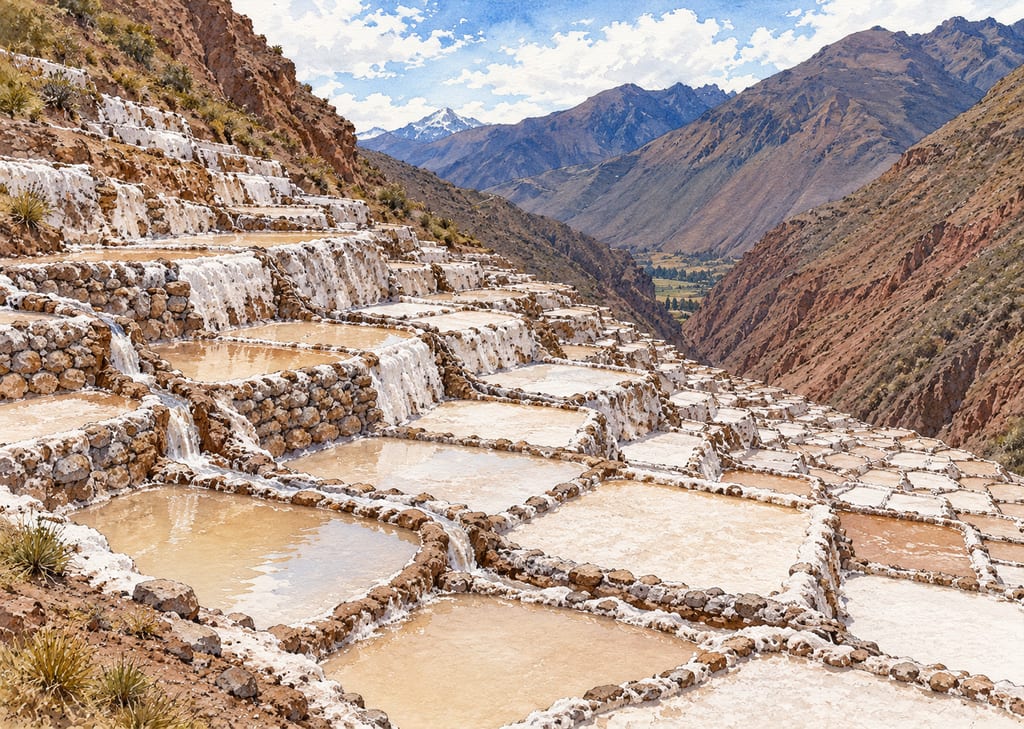
Salineras de Maras
The Salineras de Maras are an Andean spring-fed salina: shallow evaporation wells descend a steep slope, supplied by branching gravity channels from saline water.
 FermenteaWhere food goes to change
Place · salt-evaporation-pans-and-salina
Salinas de Añana · Añana saltworks · Añana salt pans
Valle Salado de Añana is an inland spring-brine saltworks in Álava, Spain, where wooden channels carry brine by gravity to stepped terraces of shallow evaporation pans.
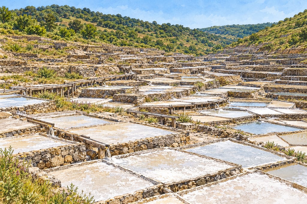
Valle Salado de Añana is a salt-production landscape beside the town of Salinas de Añana, also known in Basque as Gesaltza Añana, in Álava, within Spain’s Basque Autonomous Region. It is an in-place working system rather than a single portable salt pan. The landscape gathers natural springs, wooden brine channels, storage wells, stepped terraces and many shallow evaporation surfaces into one valley setting.
The site is included on UNESCO’s Tentative List, following Spain’s 2012 submission. That status is distinct from inscription on the World Heritage List. UNESCO presents the works as an evolving cultural landscape: successive generations changed the arrangement and construction of terraces to meet production needs. It describes the site as a living landscape and records more than 1,200 years of written history for the brine-distribution system. These records document the system’s long history, but they do not date every existing wall, well or pan.
FAO designated the Agricultural System of Valle Salado de Añana as a Globally Important Agricultural Heritage System in 2017. That designation reflects the relationship among salt production, local knowledge, water distribution and the surrounding landscape. It should not be confused with UNESCO World Heritage inscription.
Añana is an inland saltworks. Salty water emerges naturally from springs rather than arriving as seawater from a coast. The Foundation describes the usable springs as surface sources that do not require drilling or pumping at the point where brine is collected. Hollowed pinewood logs carry water through a network of channels called royos. The channels are supported where necessary so that brine continues to flow downhill by gravity.
UNESCO describes hundreds of channels and a distribution system with written documentation extending more than 1,200 years. The Foundation explains that a controlled allocation system was necessary because many salt makers shared a limited supply. The network connects springs with wells and the terrace areas. This coordinated flow is part of the build’s identity; it cannot be reduced to a generic set of evaporation pans.
The sources do not provide a full engineering plan or set of current operating rules. Their descriptions support the broad arrangement and material choices, not exact channel sections, gradients, junction details or construction tolerances.
Salt workers built terraces adapted to the irregular valley slope. UNESCO and the Foundation describe stone, wood and clay in the structures; the Foundation explains that basic stone walls can support wooden terrace construction. The stepped arrangement provides level working surfaces for the evaporation pans, while spaces beneath some eras have served as salt stores. The appearance of the landscape is therefore tied to its production and storage functions.
The shallow, horizontal evaporation platforms are called eras. The Foundation reports that individual eras vary in surface area from about 12 to 20 square metres. It calls groups of eras worked by one owner granjas. These names and sizes describe Añana’s site terminology and reported practice; they are not universal dimensions or construction requirements for all saltworks.
Brine is spread over the eras and loses water through natural evaporation, leaving salt crystals to be collected. The Foundation describes more than 2,000 recovered eras in production on its architecture page. That figure belongs to the Foundation’s description of the restored working site and can change. It does not imply that every terrace visible today is active or that each pan follows an identical schedule.
The Foundation’s production account documents tools and steps associated with the working landscape. Brine is poured over the eras to a reported depth of 2–4 centimetres, and sun and wind drive evaporation. Depending on the salt product sought, workers may remove the delicate surface crystals with specific tools or stir them into the brine so mineral salt forms more uniformly. A rodillo stirs the liquid; a regadera, a bowl on a long wooden handle, adds warmed brine to dry areas. A trabuquete is used to fill some wells, and small calentadores warm brine more quickly. Their heating source and construction are not described.
The Foundation says workers collect salt while some water remains, heap it at the centre of the era and let excess liquid drain in chestnut-wood baskets before storing it beneath the pans. October transfer to warehouses for cleaning and packaging is part of the described current annual cycle. Weather changes the production season, which generally runs from May through September. These details record the living site’s practice rather than universal requirements for other salinas.
The works are fragile and need ongoing maintenance. Salt water, weather and the demands of production affect wooden channels, terrace supports, waterproofing and pan surfaces. The Foundation’s restoration programme began with a multidisciplinary master plan developed from 2000 to 2004, followed by implementation and management work before the Foundation was established in 2009. The Foundation says it now manages restoration and production.
UNESCO’s dossier makes clear that the landscape has not retained one fixed design. It describes historic changes to pan surfaces and construction, including interventions around 1801 and later surface treatments. Restoration decisions therefore need to be understood as part of the site’s continuing history, rather than an attempt to reproduce a single timeless version.
This page is a source-based account of the existing saltworks, not a reconstruction manual. The cited sources do not supply load calculations, foundation sections, timber specifications, clay thicknesses, water-quality controls or a complete sanitation and production-validation protocol. The site’s traditional and modern maintenance should be interpreted by its responsible stewards, and visitors should follow their access and conservation guidance.
The UNESCO Tentative List describes the landscape as developed through successive adaptation and cites a brine-distribution system documented in writing for more than 1,200 years. It also notes continued changes in terrace form and construction, including major improvements around 1801. The Fundación Valle Salado describes a long history and current restoration, but those claims do not date each surviving terrace or pan. This page therefore treats the site as an evolving landscape rather than a single-period construction.
This is a heritage-site description, not a structural design or authorization to build or collect salt. The landscape is maintained by its responsible organization; visitors and proposed works should follow site guidance.
Reference point supplied in Spain's UNESCO tentative-list submission for the salt valley landscape, not an individual evaporation platform or entrance.
The Salineras de Maras are an Andean spring-fed salina: shallow evaporation wells descend a steep slope, supplied by branching gravity channels from saline water.
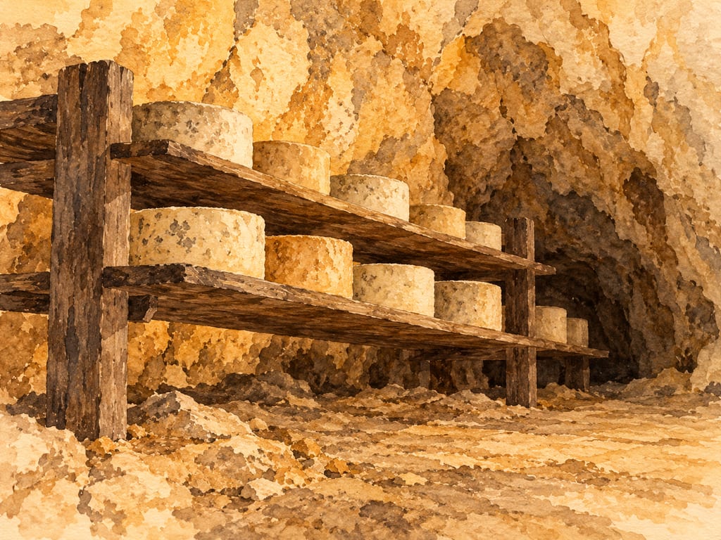
Natural limestone caves in Asturias’s Picos de Europa are used to mature Cabrales cheese. Their airflow, humidity and water are part of the site; the documented cave conditions should not be generalized to other ripening rooms.
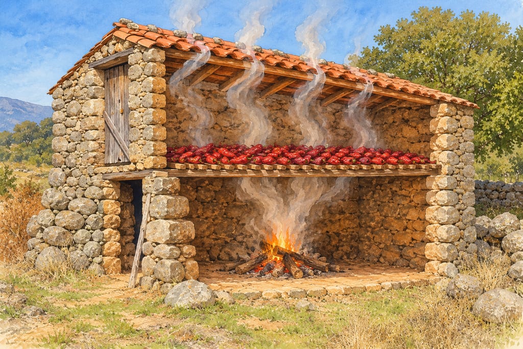
The traditional two-level pepper-drying building used for Pimentón de la Vera puts a wooden drying floor above an oak or holm-oak hearth, with heat and smoke rising through the peppers.
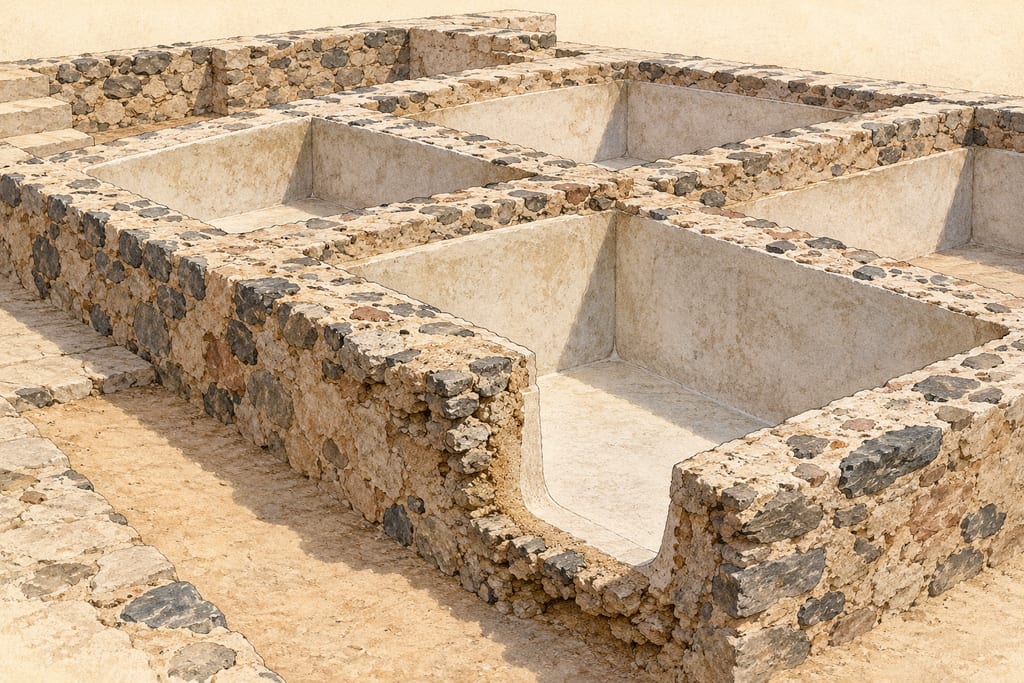
A cetaria is a fixed masonry basin in a Roman fish-processing installation. Examples at Baelo Claudia, Tróia and Monte Molião show varied forms, not one universal design.
An industrial fermentation patio places factory-made fiberglass-reinforced polyester olive tanks below floor level, with drainage and transfer infrastructure arranged around the buried vessels.
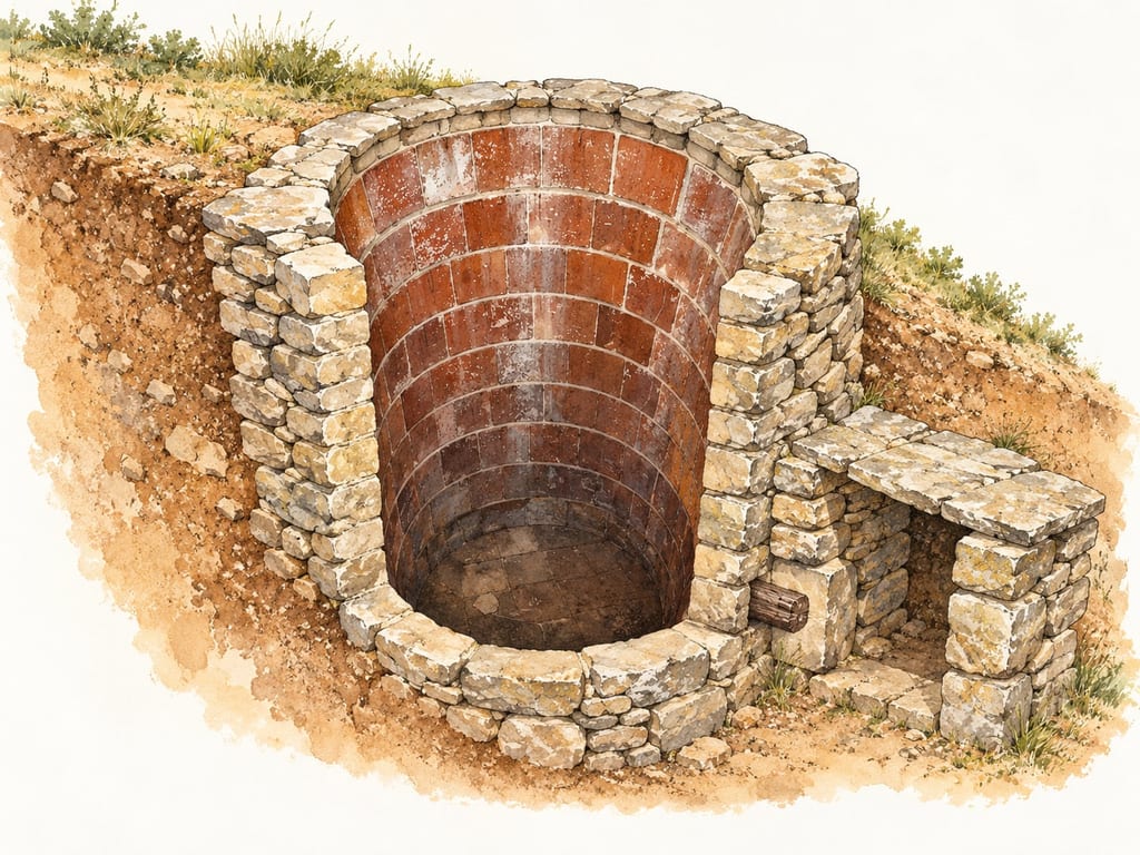
A tina de pedra seca is a fixed stone-built wine vat found among vineyards in Catalonia’s Bages region. These installations used dry-stone masonry and an inner lining of glazed ceramic cairons; variants and individual layouts differ.
No community contributions have been published for this entry yet.
Sign in to contribute. Published comments and photos are free to read.
UNESCO World Heritage CentreHistory · Geography · Structure · Heritage status
Valle Salado de AñanaSpain submitted the cultural site to the UNESCO Tentative List in 2012; it is a tentative-list entry, not an inscription.
The site lies in the southwest Basque Autonomous Region and borders Salinas de Añana/Gesaltza Añana.
UNESCO describes staggered terraces made over time with stone, wood and clay, salt pans, channels and a brine-distribution system with more than 1,200 years of written documentation.
The dossier describes successive changes to the structures and salt-making techniques, including changes introduced around 1801.
Cited in: An inland salt landscape shaped over time; Spring brine and gravity channels; Terraces, eras and production; Care, restoration and what the evidence does not specify
Fundación Valle Salado de AñanaStructure · Method · Materials · Maintenance
Salt-related architectureThe landscape has more than four kilometres of wooden channels directing brine from springs to wells and terraces.
The Foundation describes stone, wood and clay as construction materials used by salt workers.
Brine moves through channels called royos by gravity.
Horizontal evaporation platforms are called eras; the Foundation reports 12–20 square metres per era and groups of eras worked by one owner as granjas.
The Foundation describes current restoration and production and notes the need for continuing maintenance.
Cited in: Spring brine and gravity channels; Terraces, eras and production; Care, restoration and what the evidence does not specify
Fundación Valle Salado de AñanaHydrology · Method · History
Water systemNatural springs supply brine at the surface, and the site describes four usable springs.
Hollowed pinewood logs form a gravity-fed channel network exceeding four kilometres.
The system is managed through a distribution schedule and written water-use rules documented for more than 1,200 years.
Cited in: Spring brine and gravity channels
Food and Agriculture Organization of the United NationsMethod · Landscape · Community · Heritage status
The Agricultural System of Valle Salado de Añana, SpainFAO reports designation as a Globally Important Agricultural Heritage System in 2017.
FAO describes spring brine channeled by gravity to wells and pans, stepped terraces built with dry stone, wood and clay, and salt production by natural evaporation.
The source describes the salt-pan groups and shared distribution system as part of the living production landscape.
Cited in: An inland salt landscape shaped over time; Terraces, eras and production
Fundación Valle Salado de AñanaRestoration · Stewardship · Present use
Fundación Valle Salado de AñanaThe Foundation describes a master plan prepared between 2000 and 2004, implementation in 2005–2008 and establishment of the Foundation in 2009.
The Foundation identifies itself as the owner and steward responsible for restoration, conservation and production using traditional techniques.
Cited in: Care, restoration and what the evidence does not specify
Fundación Valle Salado de AñanaMethod · Tools · Season · Storage
Cómo se produceThe Foundation says the production period varies with weather, generally from May to September.
It describes filling eras with 2–4 cm of brine exposed to sun and wind; the next four hours are described as crystallization time.
Named tools and features include a trabuquete for filling some wells, tools used to collect fleur de sel, a rodillo to stir brine, a regadera made from a bowl attached to a long wooden handle, and small calentadores where brine is heated more quickly.
Salt is gathered while some water remains, piled at the center, drained briefly in chestnut-wood baskets, and stored beneath the eras; in October it is moved to other warehouses for cleaning and packaging.
Cited in: Terraces, eras and production